Posters & Graphic
3D Urban Systems Atlas Infographic
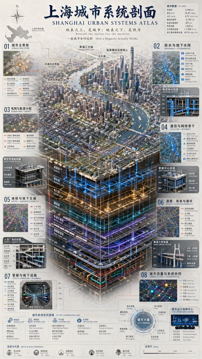
Copyable AI Image Prompt
No.14163A hyper-detailed bilingual Chinese-English infographic poster titled “Shanghai Urban Systems Atlas,” featuring an isometric aerial view of central Shanghai with the Huangpu River and Lujiazui skyline above a dramatic vertical cutaway of the city’s hidden infrastructure below, showing stacked underground layers for drainage and stormwater, power grid, telecom and data networks, metro and transport tunnels, utility corridors, plumbing, and coordinated control systems; dense numbered callout panels around the edges with maps, diagrams, legends, cross-sections, icons, and technical labels; editorial urban-planning atlas design blending photorealistic 3D city rendering with precise schematic visualization, clean cream background, blue cyan amber and violet network lines glowing through the subterranean layers, crisp architectural detail, fine typography, subtle atmospheric haze, soft daylight over the skyline, luminous neon-like infrastructure below, sharp focus, ultra-high resolution, eye-level isometric perspective, polished museum-quality systems map poster.